
Poulsbo Event & Recreation Center

Project Location
1135 NW Reliance ST
Poulsbo, WA 98370
Construction Progression
Weekly Updates
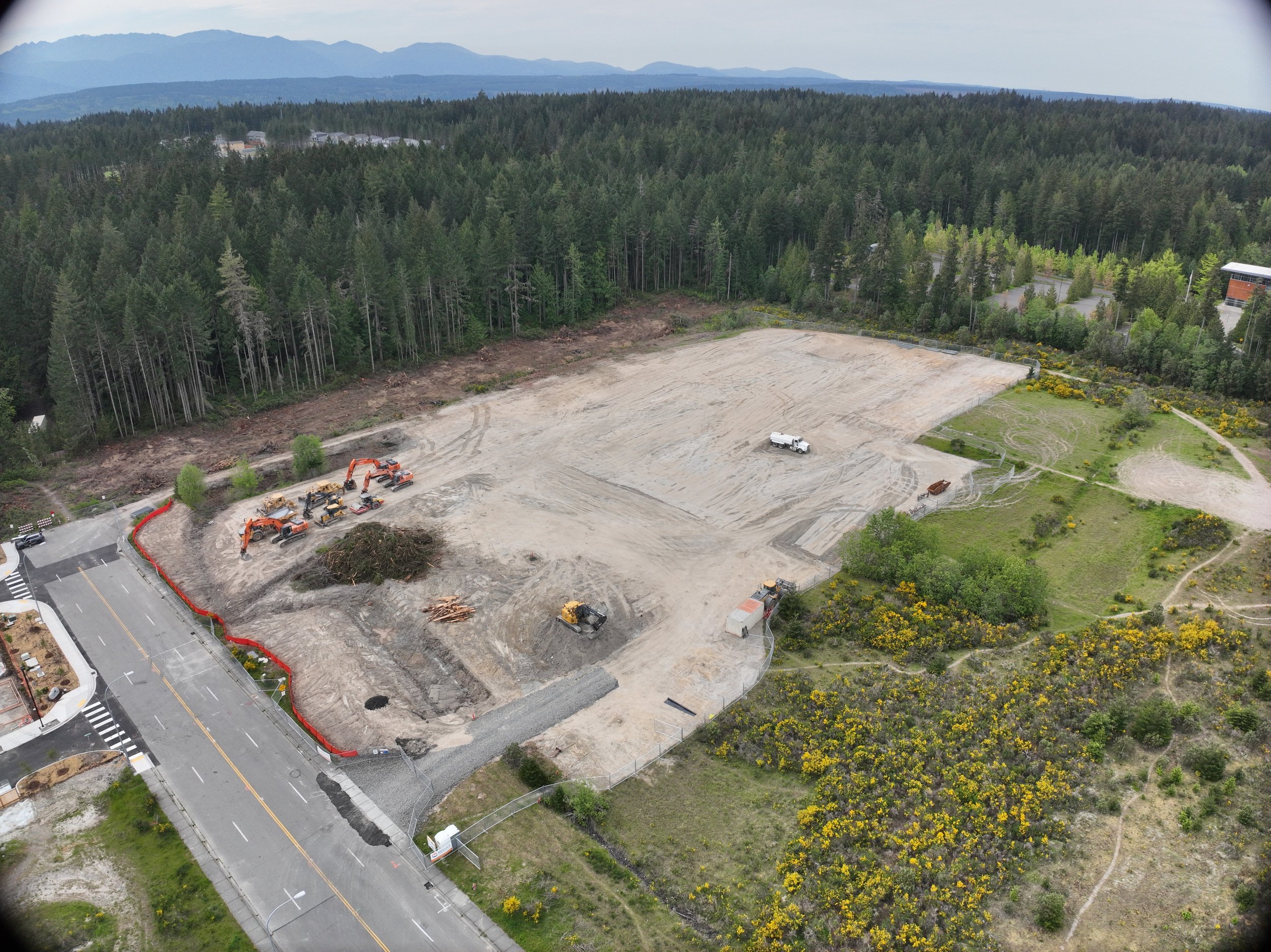
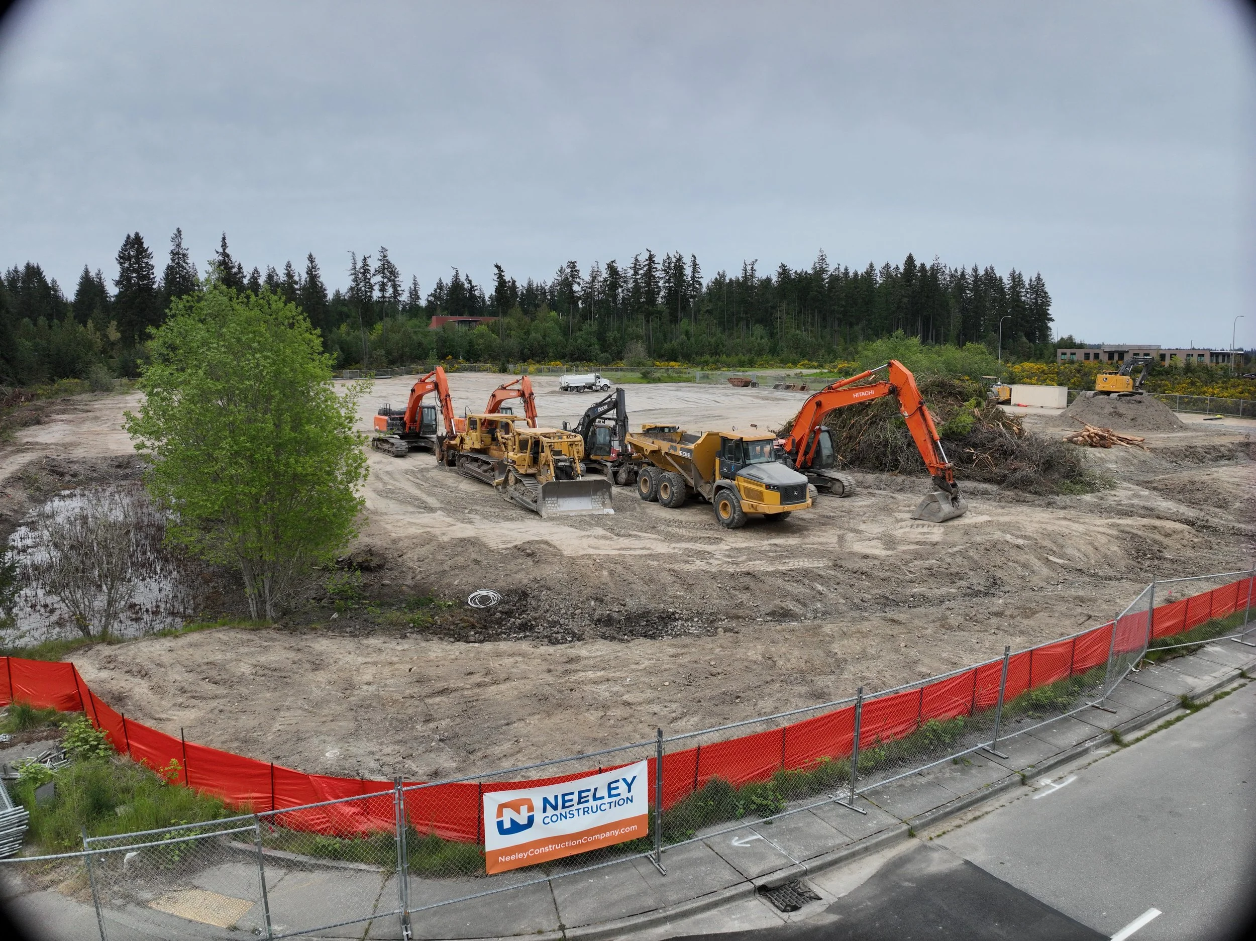
Initial Capture: May 3, 2026
Current Capture: June 7, 2026
Next Capture: June 21, 2026
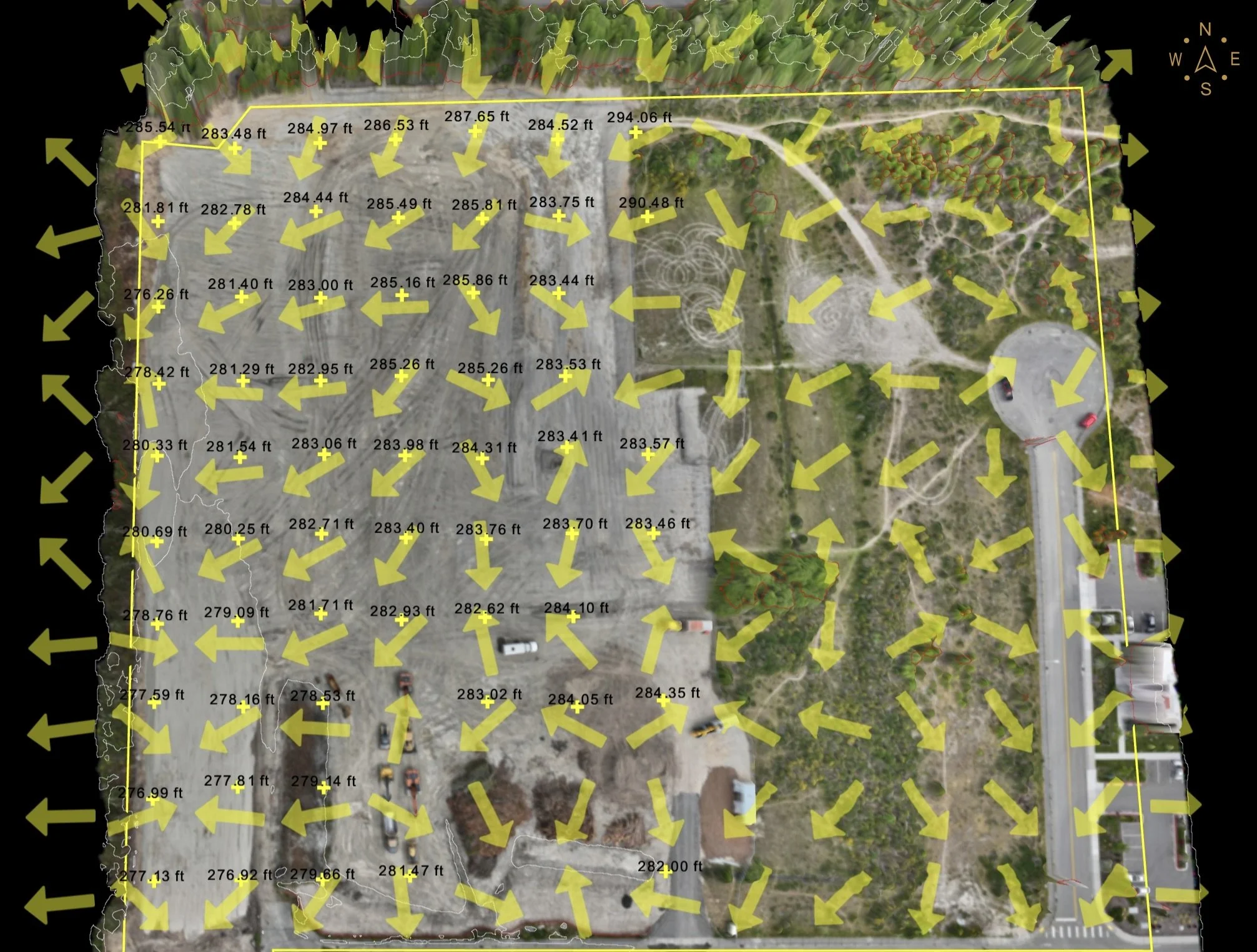
Access 2D/3D Analysis Toolset - measure area, angles, lines, heights, slopes, stockpiles
Site Terrain Analysis
Slope & Elevation
Because PERC is primarily going to be playing surfaces and ball fields it make sense the site is so level. This deliverable shows the shape of the site using elevation points and directional slope arrows. The numbers indicate approximate surface elevations, while the arrows show the direction water or surface grade is likely to move across the site.
For construction crews, this kind of view can help make site conditions easier to understand before work begins or between project phases. It can support conversations about drainage, grading, access routes, stockpile placement, erosion concerns, and areas that may need closer field review.
This is not a substitute for engineering design or a licensed survey, but it gives project teams and community viewers a clearer picture of how the land slopes and how the site is organized. It is especially useful when paired with aerial imagery, 3D site views, and progress updates over time.
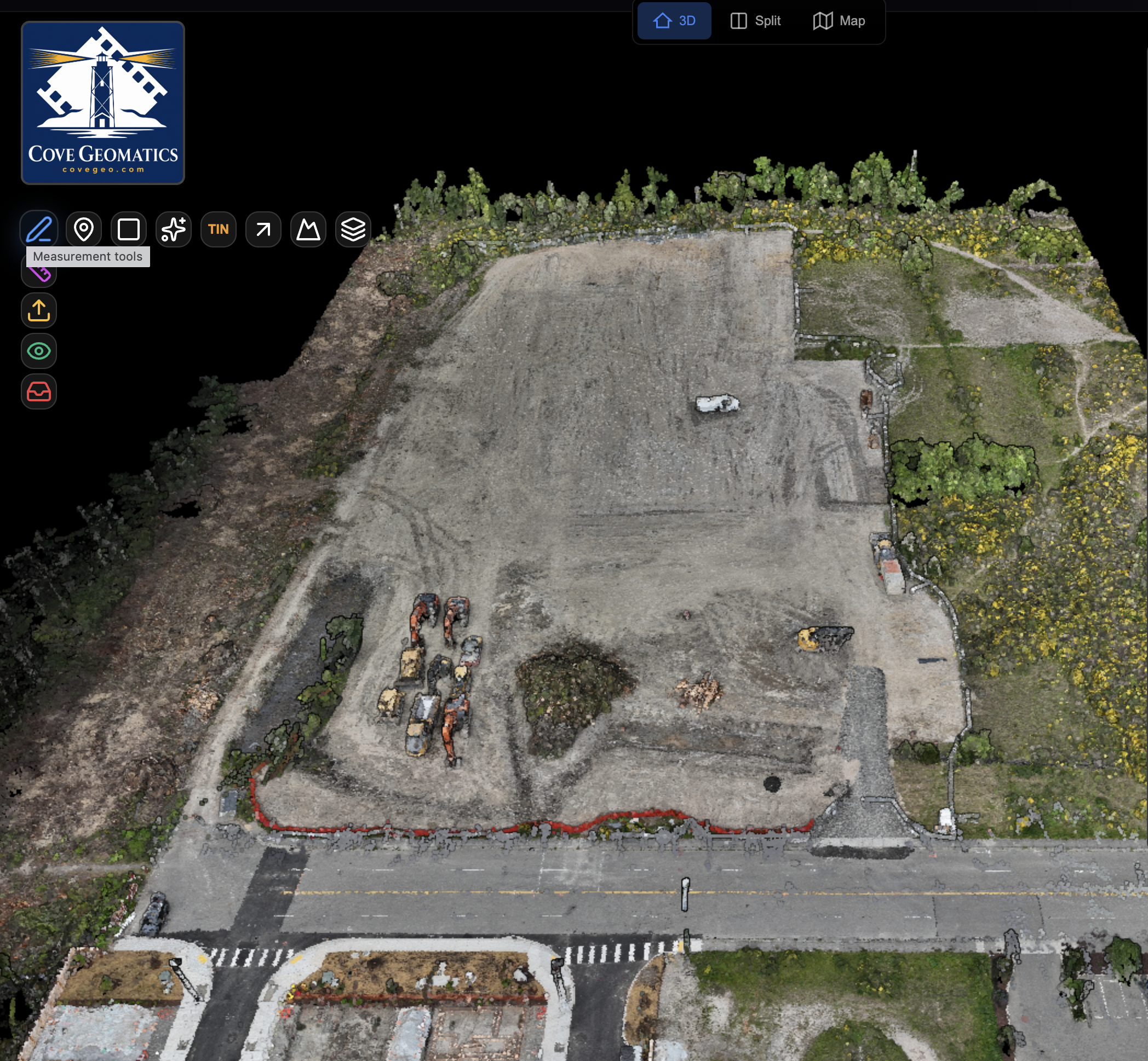
Site Modeling in 3D
This deliverable turns site capture data into an interactive 3D view of the project area. Instead of looking only at flat photos, viewers can rotate, zoom, inspect site features, and better understand how the property or construction area is laid out.
For construction crews and project teams, 3D models can support planning, progress review, access discussions, condition documentation, and communication with owners or stakeholders. It is not a substitute for a licensed survey or engineering model, but it provides a clear visual reference for understanding the site.
Click Model to Interact
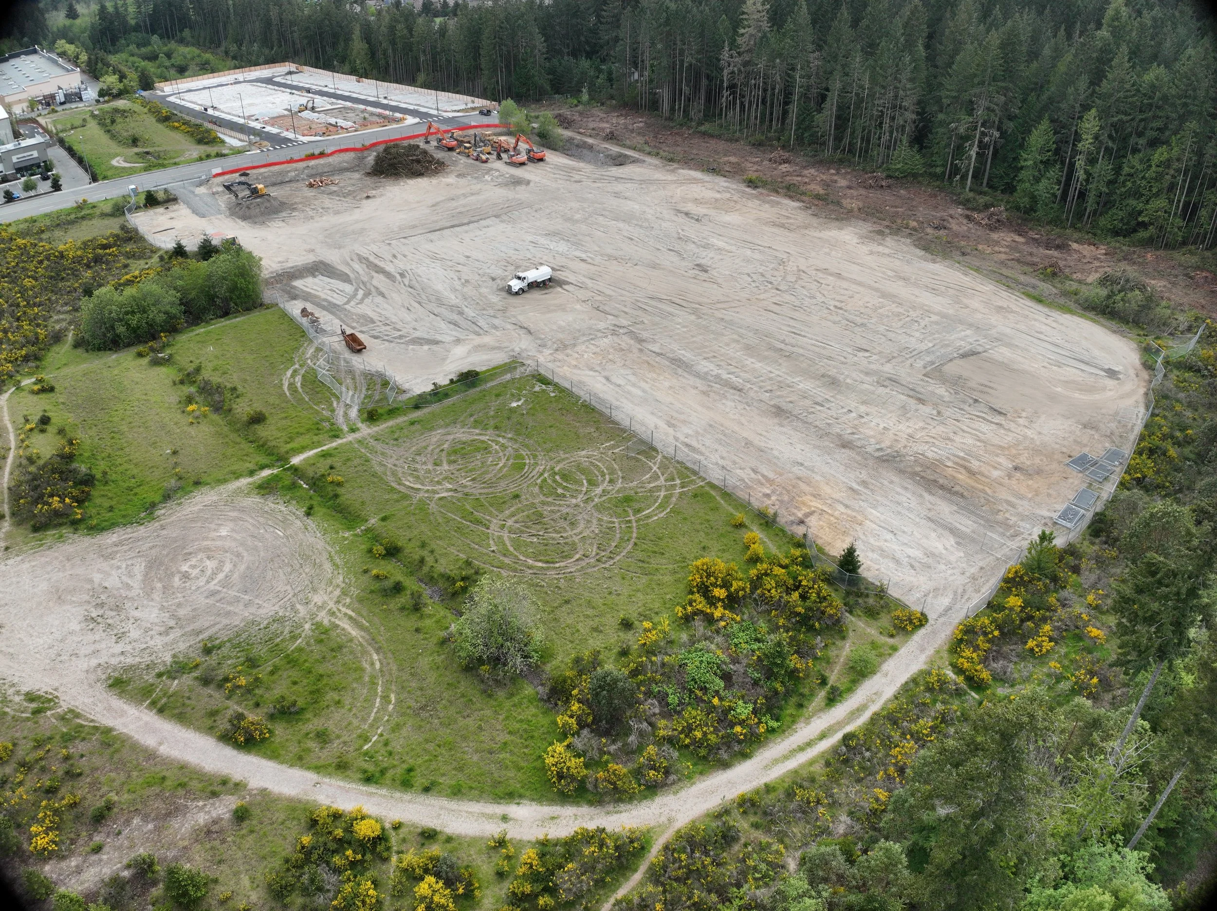
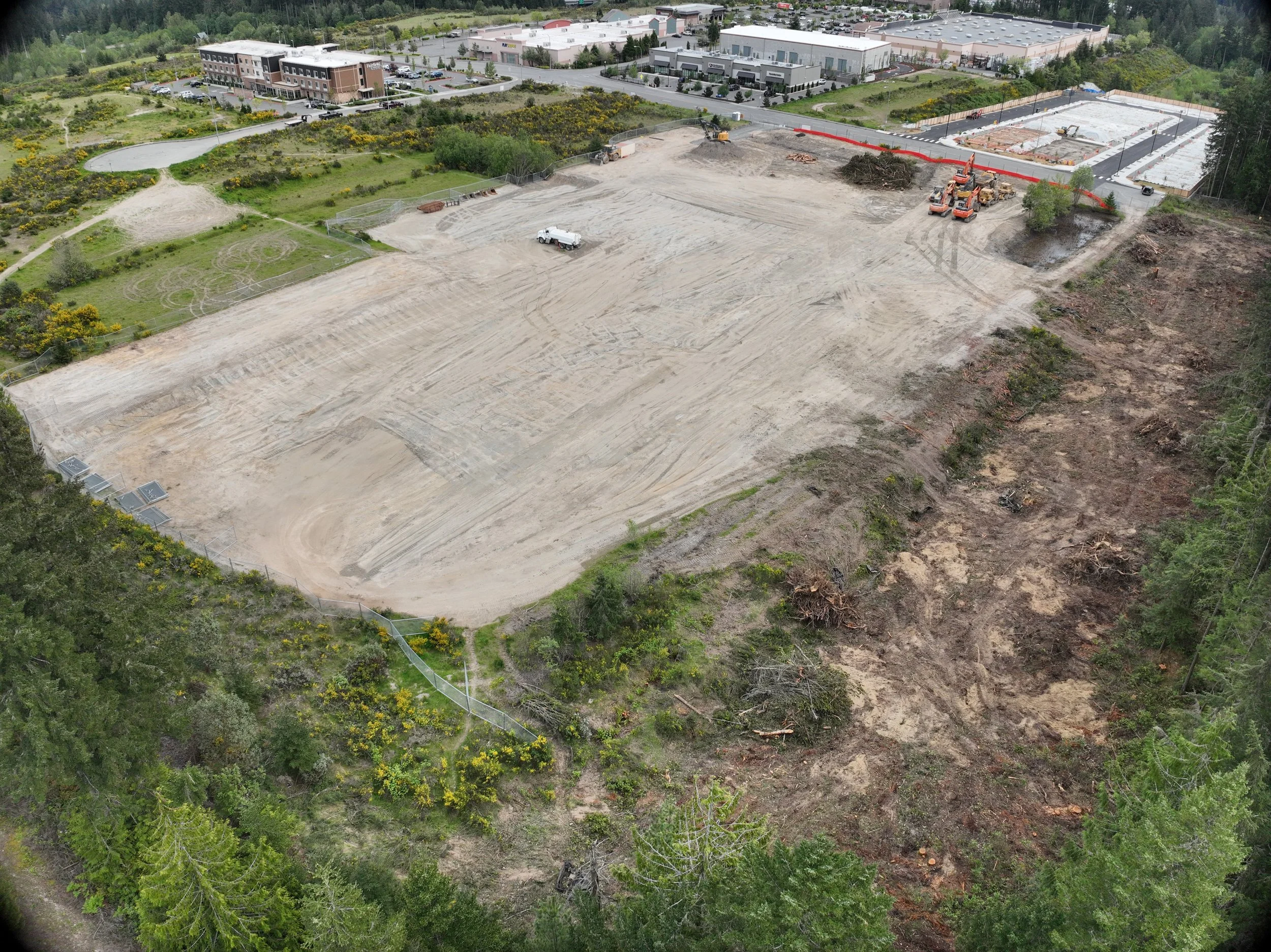
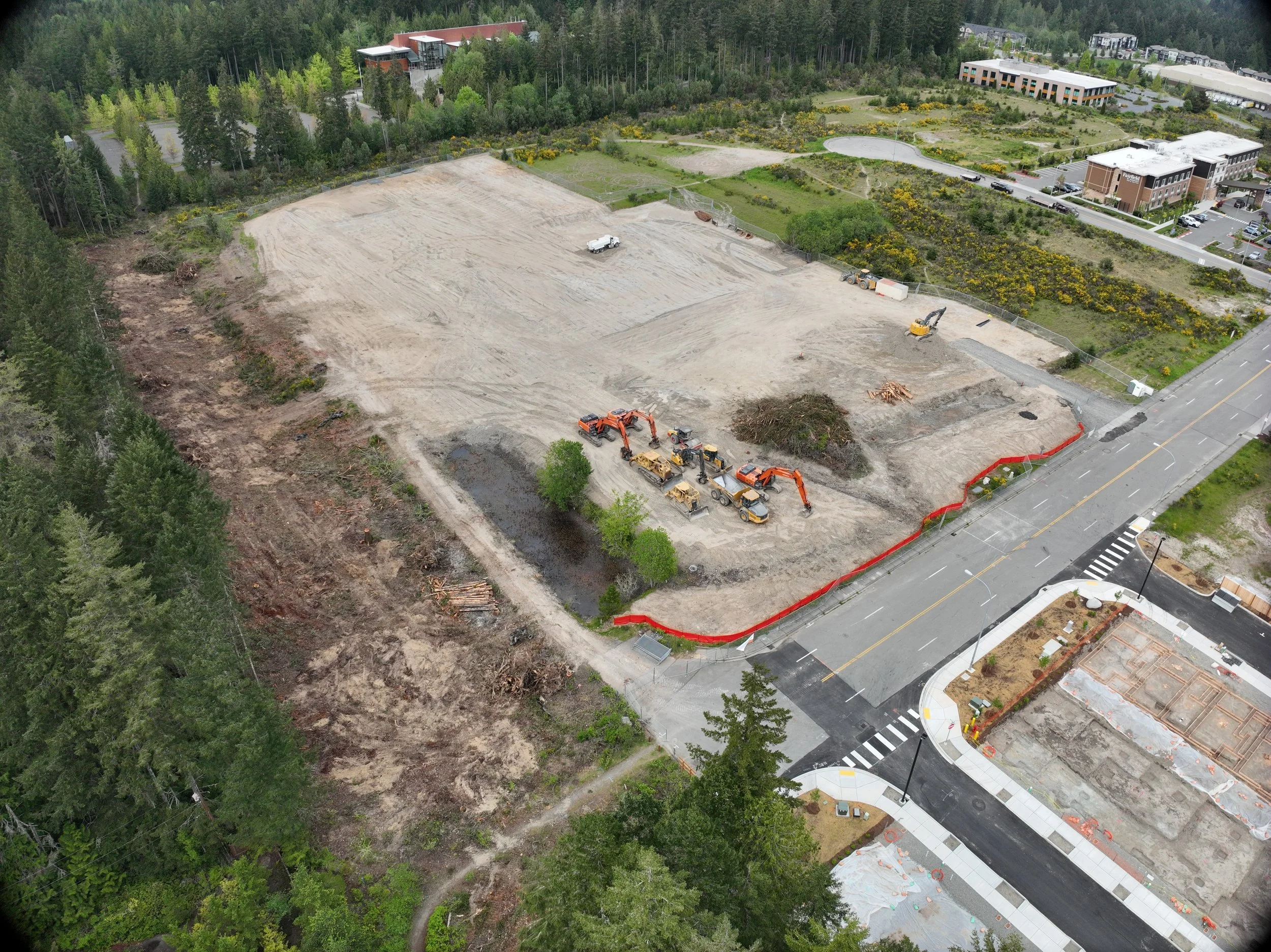
Site Modeling in 2D
This deliverable provides a clear overhead view of the site created from aerial capture data. It helps viewers understand the layout of the property, visible site conditions, access points, work areas, materials, and changes over time.
For construction crews and project teams, 2D site views can support progress review, planning discussions, visual documentation, stakeholder updates, and coordination without relying only on ground-level photos or site visits.
Click Model to Interact