Site Capture Packages — Starting at $295.
Our Site Capture service can be delivered as a standard image package, a data package, or both.
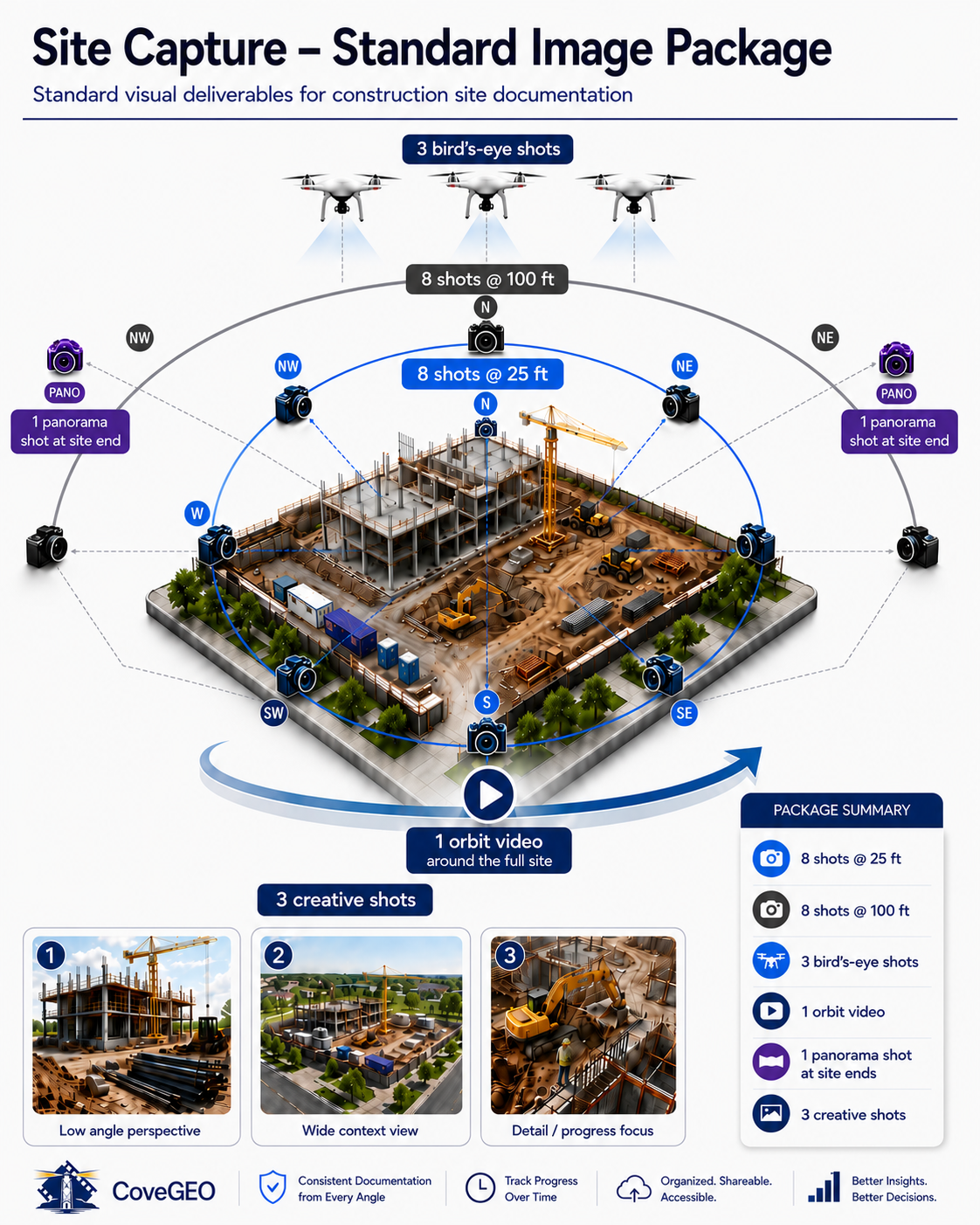
Standard Image Package — $295
Includes a repeatable set of site photos, panorama views, orbit video, and creative site images designed for documentation, progress review, and stakeholder communication. Photos of additional areas of interest are available by request at no additional cost, and we are happy to modify the capture plan to fit your site requirements. Local pricing for standard sites. Travel, access constraints, airspace restrictions, site size, safety requirements, and specialized deliverables may affect final pricing.
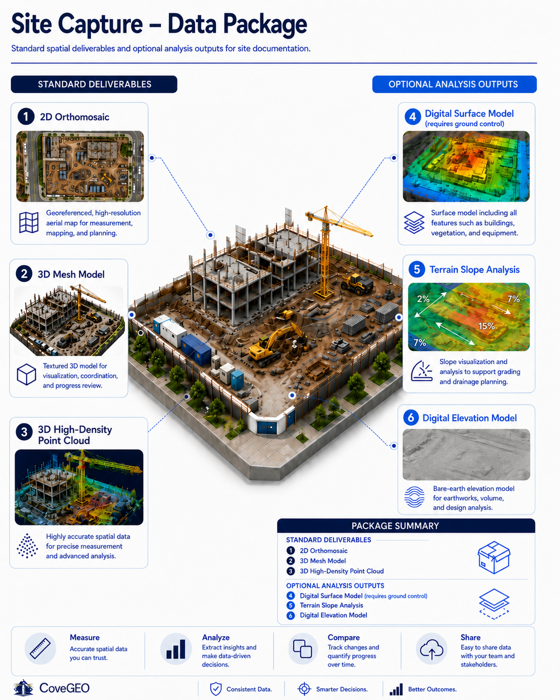
Standard Data Package — Add $200
For sites up to 50 acres, the standard data package adds core spatial deliverables such as a 2D orthomosaic, 3D mesh model, and high-density point cloud.
Optional Data Deliverables
Additional outputs such as surface models, terrain analysis, elevation models, contours, specialized exports, or follow-on site analysis are quoted based on site conditions and project requirements. Some data deliverables may require ground control or additional field procedures to meet higher accuracy requirements.
CoveGEO deliverables are intended for site documentation, planning, progress review, and visual decision support. They do not include legal boundary lines or property marker locations and are not a substitute for a licensed survey when legal, boundary, engineering, or record-grade deliverables are required.
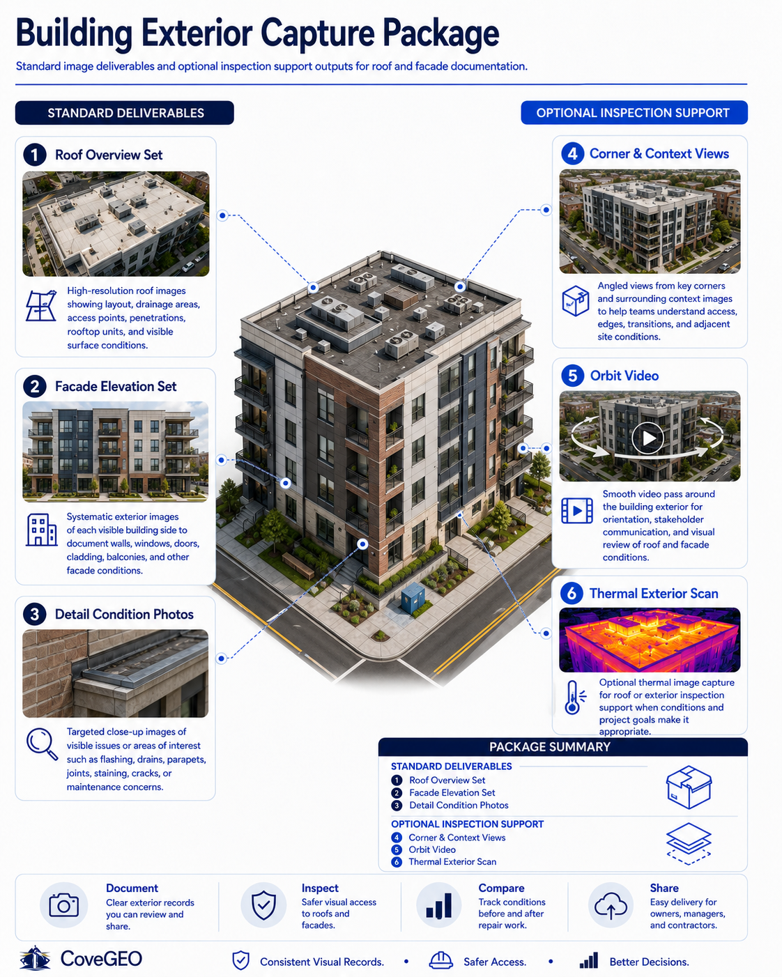
Building Exterior Capture
Standard Building Exterior Package — $495
High-resolution roof and facade image capture for commercial buildings, multifamily properties, facilities, and construction projects. CoveGEO documents rooftops, walls, edges, equipment, drainage areas, access points, and visible exterior conditions from multiple angles so your team can review the structure safely, efficiently, and with better visual context.
Includes: roof overview images, facade elevation images, corner oblique views, close-up detail photos, site context images, and an optional orbit video.
Common uses: roof review, facade documentation, maintenance planning, repair scoping, insurance support, owner updates, contractor coordination, and before/after repair documentation.
Note: CoveGEO provides visual documentation and inspection support imagery. Formal condition assessments, engineering opinions, and repair recommendations should be provided by the appropriate qualified professional.