
Property & Site
Capture, Review & Tracking
High-resolution aerial and ground capture for construction projects, commercial properties, and infrastructure. Deliverables can include interactive 2D/3D views, inspection imagery, digital twins, point clouds, orthomosaics, elevation models, and AEC-ready outputs to support your project team.
We help surveyors, engineers, contractors, property managers, and owners document conditions, track change, and coordinate work before, during, and after on-site activity.
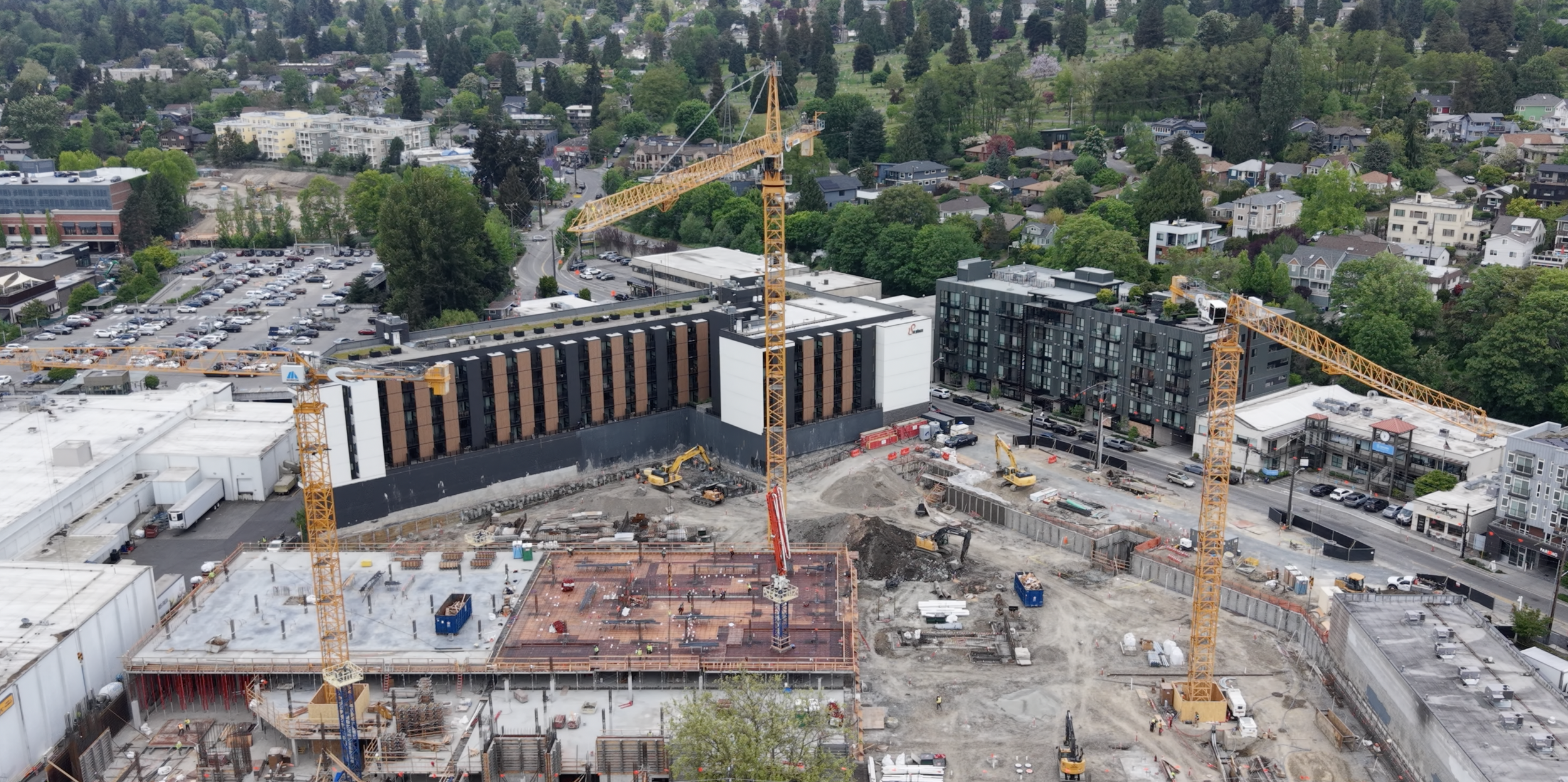
Your Western Washington partner for tangible property and project documentation
Evidence Of Progress
Project Risk Mitigation
Visual Documentation of As-Built Conditions
Property Condition Tracking
Asset and Property Protection
Make faster decisions
High-resolution property and project documentation, managed locally and delivered directly
What We Deliver
Practical site capture, hosted project tools, and progress documentation for teams that need a clearer view of the work.
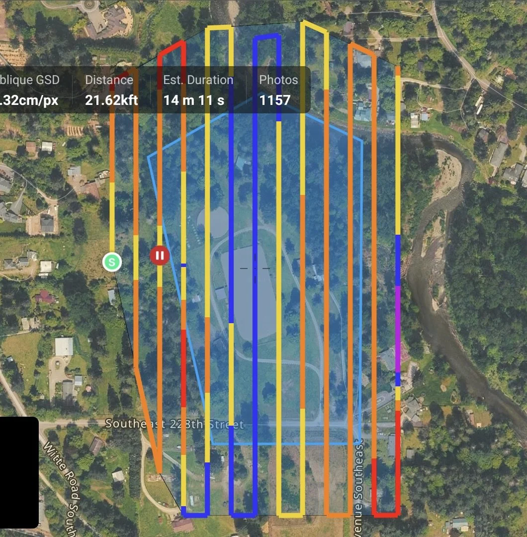
Site Capture
Aerial and terrestrial reality capture for existing conditions, documentation, inspections, planning, and downstream architectural, engineering and construction workflows.
Digital Surface Model & Elevation Model
3D Dense Point Cloud
2D Orthomosaic of the property
Perimeter and Feature Images
Orbit Videos and Panoramas
Inspection support imagery for structures, roofs, and site features.
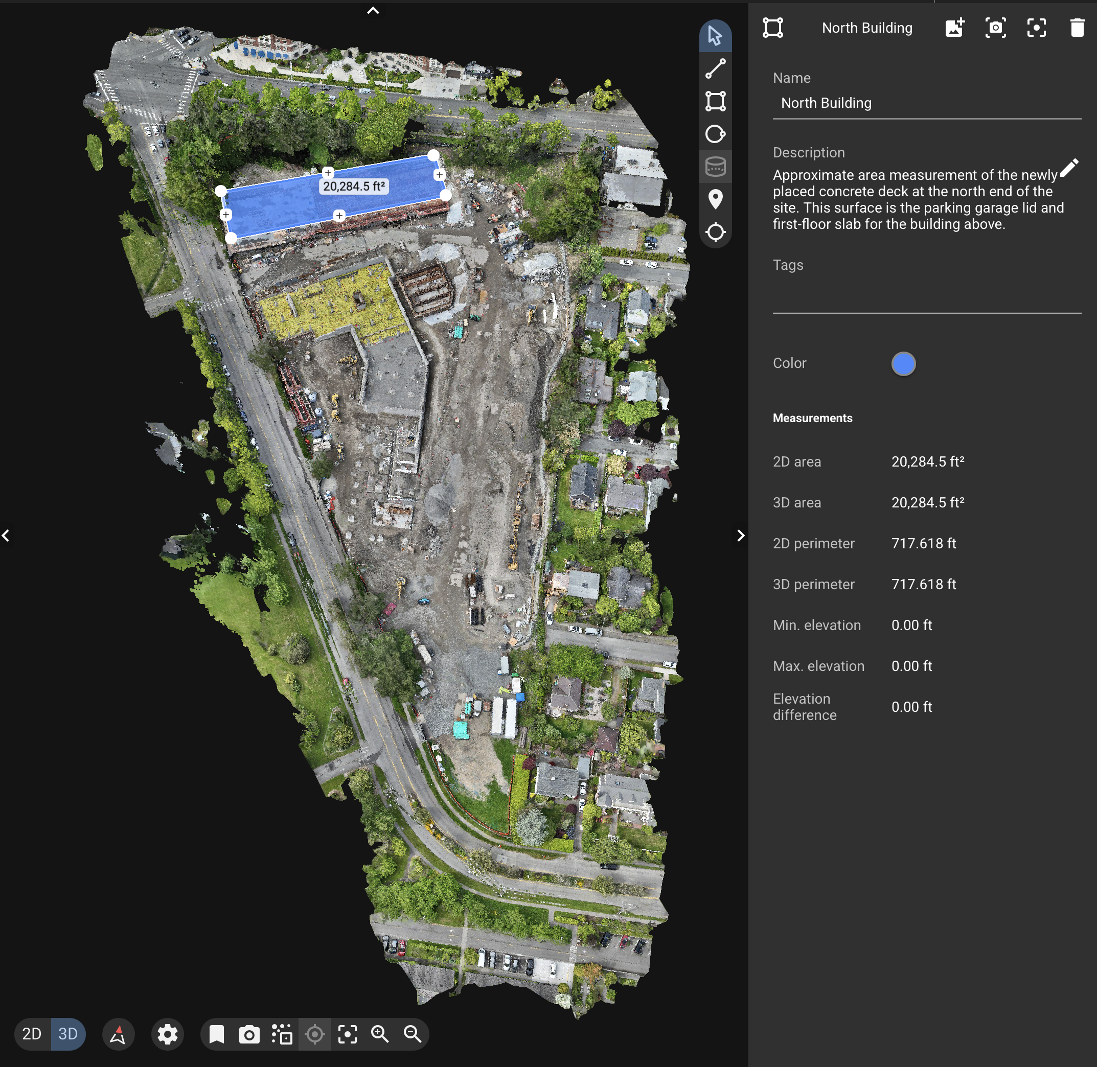
Site Intelligence
Flexible options for site documentation, visual mapping, progress comparison, and measurement-support reports. Depending on the project, deliverables may include feature documentation, vegetation context, surface models, stockpile volume estimates, hosted viewers, photo libraries, and downloadable project files.
We provide hosted tools for visualization, measurement, annotation, and analysis that help you review existing conditions and make faster project and property decisions. Your data is available in standard industry formats for your team to process or work with partners.
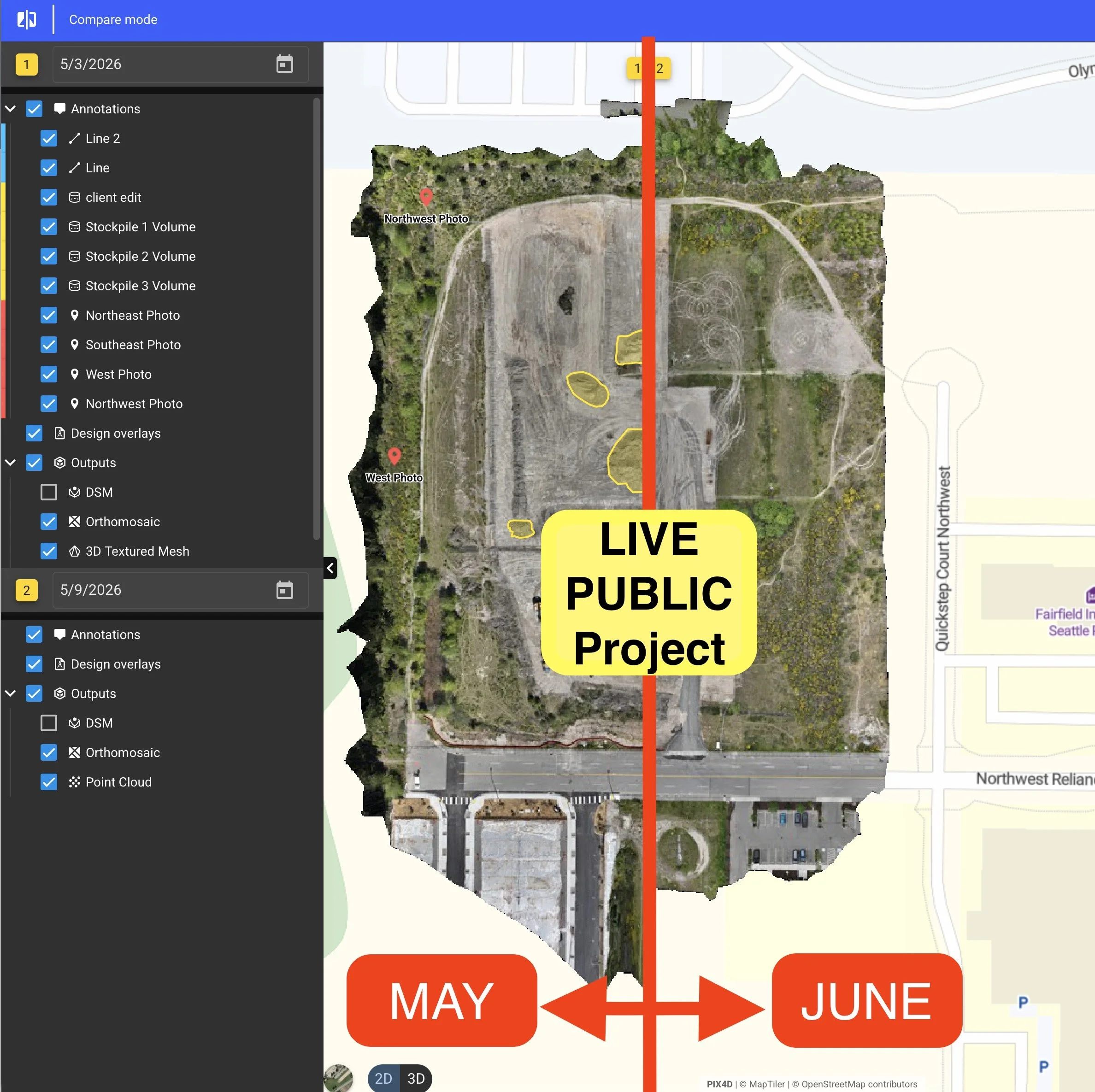
Progress Tracking
Recurring aerial site updates with high-resolution site views, photos, video, and visual reporting to help teams monitor progress, coordinate stakeholders, resolve disputes, and document site conditions over time.
Aerial + Ground Reality Capture
CoveGEO documents sites, structures, and assets using a field capture stack built around aerial mapping, terrestrial LiDAR, SLAM scanning, thermal imaging, high-resolution photography, hosted digital twins and 3D review tools.
This gives clients a practical record they can review, measure, compare, annotate, and share — from broad property context down to ground-level details.
Capture methods may include:
Aerial mapping for 5-100 acre sites, orthomosaics, digital surface models and full- property context
Aerial LiDAR for terrain beneath vegetation, ground classification, surface models, elevation analysis, and structure-aware capture.
Terrestrial LiDAR / SLAM scanning for interiors, ground-level detail, and obstructed areas
Thermal imaging for roof, exterior walls, material temperature tracking, heat-loss patterns and anomaly screening
High-resolution imaging for centimeter-level inspection detail, condition records and scalable asset documentation
360° / 3D aerial + ground co-capture fusing point clouds into virtual site walkthroughs for all-angle condition review
Hosted digital twins for 3D review, measurement, annotation, client sharing and comparison over time.
The result is a usable visual and spatial record of what is there, what changed, and what needs attention.
On-Site Field Support

Drone Site Support
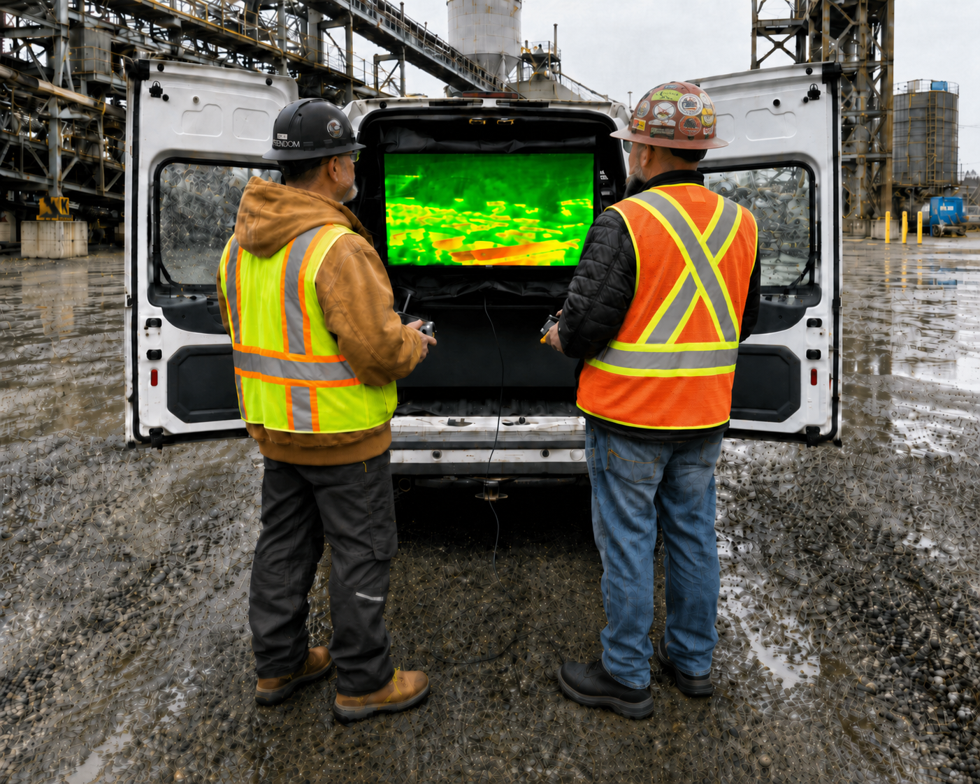
We meet you on site and follow your direction during aerial capture in real time from large field displays. Request photos, video, close-ups, creative views while CoveGEO safely handles the flight. Ideal for planners, project managers, marketing teams, and property managers who need site visuals without managing drone operations or explaining requirements to a remote provider.
Rapid local response available.
Assisted Aerial Inspection
For technical inspections, CoveGEO can provide a dual-operator aerial workflow where we safely pilot our heavy-lift aircraft while your subject-matter expert directs or controls the sensor view.
This is useful for engineers, general contractors, surveyors, inspectors, and trades who need close visual review, thermal imaging, LiDAR capture, range finding, or high-resolution photography in difficult or sensitive areas without taking on the risk of flying the aircraft themselves.
GEO-PACT
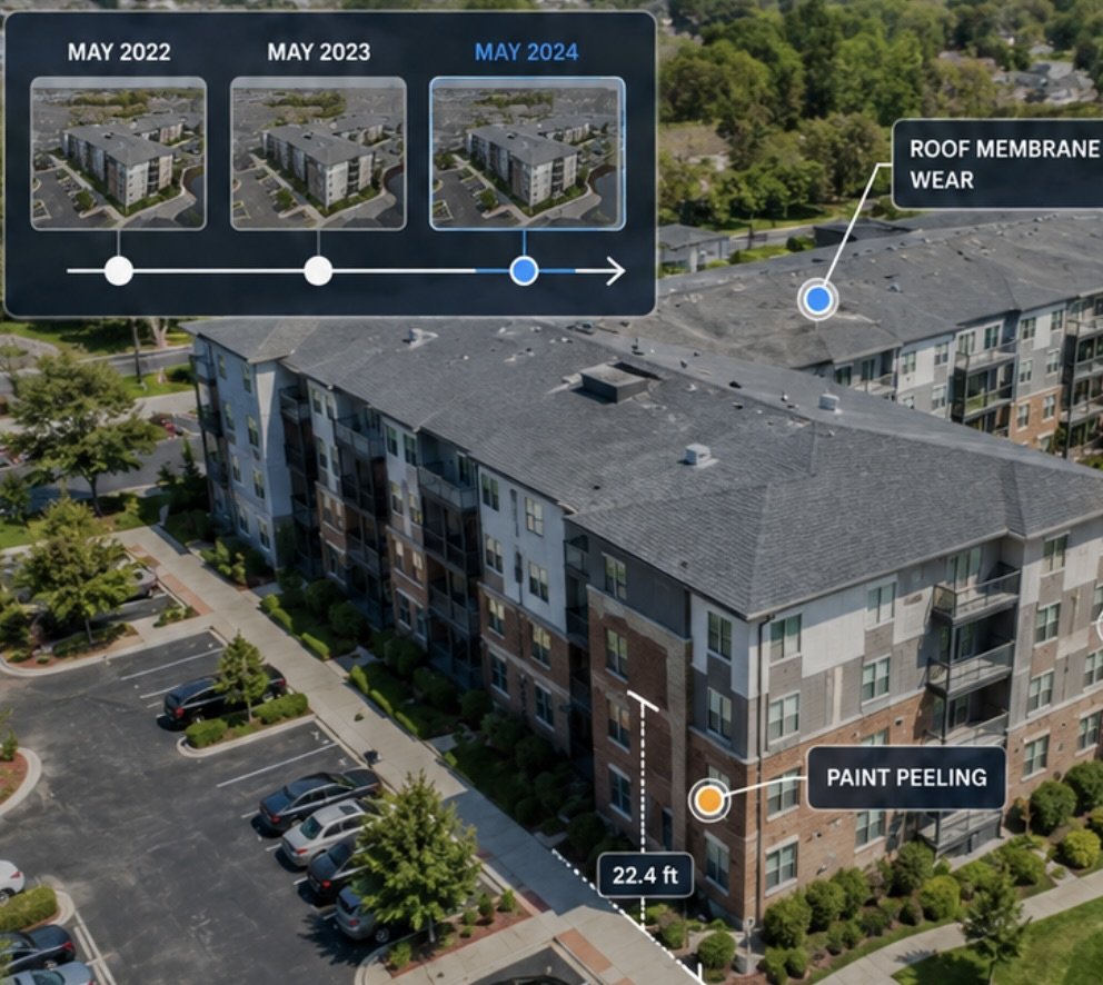
Create a high-resolution visual timeline of your property’s exterior. GEO-PACT helps owners and managers protect valuable assets by giving them a clear way to review, measure, annotate, download, and compare site conditions over time for maintenance planning, event response, dispute documentation, vendor coordination, and owner communication.
Why CoveGEO
Practical reality capture services that balance speed, quality, and cost. Managed locally. Delivered directly.
-
Fast scheduling, efficient site visits, and deliverables organized around the information your team actually needs.
-
High-resolution imagery, interactive 2D/3D views, measurement and analysis tools, and clear project documentation.
-
Flexible services for construction teams, property owners, and infrastructure projects that need useful site intelligence without unnecessary overhead.
-
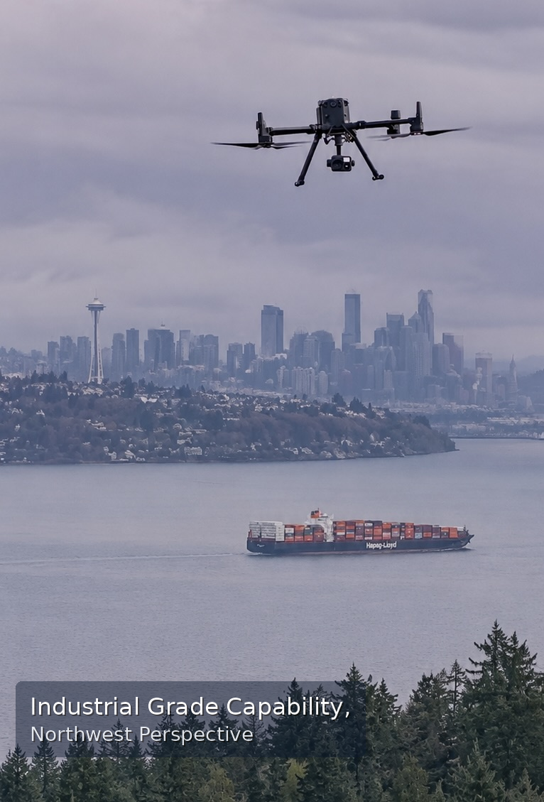
Work directly with a local pilot and field operator who understands Northwest weather, site access, and real project timelines. CoveGEO provides rapid local response, flexible capture support, and direct coordination without the friction of remote service-provider workflows or anonymous handoffs. We live and work here, and we have a stake in your success.
-
When time or budget does not yet support a formal survey or full engineering process, CoveGEO can provide rapid spatial context to help clients understand visible site conditions, evaluate options, and decide whether to move forward. This early-stage documentation is not a substitute for boundary, permitting, design, or engineering work by licensed professionals.
Your Next Step
Have a site, property, or project you need to understand more clearly?
Contact Options:
Call 425-677-5676
Complete our Client Inquiry form
Log in to our Client Portal
The client portal enables you to provide site details, upload project files and access example projects and deliverables.
FAQ
-
CoveGEO delivers organized site documentation using aerial imagery, terrestrial capture, interactive 2D/3D views, measurement tools, analysis tools, and downloadable project files. Deliverables may include site photos, videos, orthographic site views, point clouds, 3D project environments, reports, and client-access links.
-
No. CoveGEO provides site documentation, reality capture, progress tracking, visual review, inspection support imagery, and project communication tools. CoveGEO is not a licensed land surveying firm, and our deliverables are not boundary surveys, legal surveys, plats, legal descriptions, engineering certifications, or record survey documents. When boundary, legal, permitting, design, or certified survey work is required, CoveGEO can support workflows led by an appropriately licensed professional.
-
Our primary workflow is based on industry leading Pix4D , AutoCAD, and ArcGIS. We also support client workflows in DroneDeploy and other Lidar processing packages. We support all standard AEC workflow formats including LAS, E57, DXF, DWG
-
Yes. Depending on the project, CoveGEO can provide hosted access through tools such as Pix4D Cloud, Viizor.app, Assembly, or shared file folders. Hosted projects can make it easier for clients to review site conditions, access deliverables, and share information with stakeholders.
-
Yes. CoveGEO is a licensed Washington State, veteran owned small business. Field operations are conducted by a FAA commercial certified remote pilot with OSHA 10 construction safety training. We are commercially insured.
-
CoveGEO is a good fit for construction sites, commercial properties, infrastructure corridors, development parcels, facilities, and properties where visual documentation, measurements, condition review, or progress tracking would help support decisions. The best projects are sites where teams need a clear record of what exists, what changed, or what needs attention.
-
Flight work is subject to weather, airspace rules, site access, safety conditions, visibility, and other operational restrictions. If conditions are not suitable for safe or useful capture, the visit may be rescheduled. Deliverable timing depends on the size of the site, the type of processing required, and the complexity of requested analysis.
-
Site capture can be scheduled as a one-time visit, recurring progress update, or ad hoc site scan. Construction and property projects may benefit from weekly, biweekly, monthly, or milestone-based updates depending on the pace of work and the level of documentation needed.
-
Yes. Many CoveGEO deliverables can be shared as interactive project environments where clients can review site conditions, take measurements, add annotations, compare views, and communicate findings with their team.
-
CoveGEO is supported by ongoing Survey School training, Pix4D processing workflows, Pilot Byte operational resources, and veteran-focused professional networks such as Vets to Drones. We are members of the Professional Photographers Association of America. These connections help us stay current with drone operations, reality capture, mapping, safety, and AEC documentation practices while delivering practical local services for construction, property, and infrastructure teams.cription
CoveGEO provides reality capture, site documentation, and visualization services. CoveGEO is not a licensed land surveying or engineering firm. Deliverables are not boundary surveys, legal descriptions, plats, engineering certifications, or record survey documents unless incorporated into work performed under the responsible charge of an appropriately licensed professional.